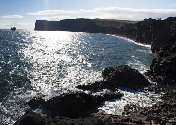
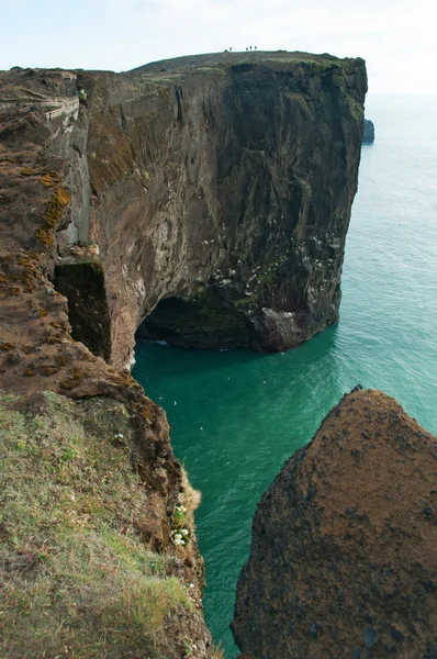
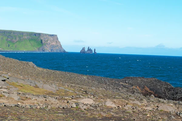
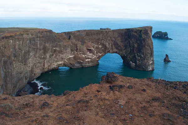
Iceland, Europe: aerial view of the gigantic black arch of lava standing in the sea on the promontory of Dyrholaey and overlooking the bay of Vik i Myrdal, the southernmost village of the island, one of the main tourist attractions of the south — 스톡 사진

Iceland, Europe: aerial view of the gigantic black arch of lava standing in the sea on the promontory of Dyrholaey and overlooking the bay of Vik i Myrdal, the southernmost village of the island, one of the main tourist attractions of the south — 스톡 이미지

아이슬란드, 2012년 09월 18일: 디롤레이(Dyrholaey)의 곶에 바다에 서 있는 거대한 검은 색 아치의 공중 전경과 섬의 최남단 마을인 빅 i 미르달만이 내려다보이는 남부 의 주요 관광 명소 중 하나

 — 님의 사진 vampy1

동일 시리즈:

Vik i Myrdal, 아이슬란드, 유럽, 08/18/2012: 레이니스드란가르의 전경, 레이니스피야라(Reynisfjara) 검은 해변의 레이니스피얄(Reynisfjall) 산 아래 현무암 바다가 쌓여 있으며, 1991년에 세계에서 가장 아름다운 10개의 비열대 해변 중 하나로 선정되었습니다.
Vik i Myrdal, 아이슬란드, 유럽: 레이니스드란가르의 전경, 레이니스피야라(Reynisfjara) 검은 해변의 레이니스피얄(Reynisfjall) 산 아래에 있는 현무암 바다는 1991년에 세계에서 가장 아름다운 10개의 비열대 해변 중 하나로 선정되었습니다. — 스톡 사진
아이슬란드, 2012년 09월 18일: 디롤레이(Dyrholaey)의 곶에 바다에 서 있는 거대한 검은 색 아치의 공중 전경과 섬의 최남단 마을인 빅 i 미르달만이 내려다보이는 남부 의 주요 관광 명소 중 하나
Iceland, Europe: aerial view of the gigantic black arch of lava standing in the sea on the promontory of Dyrholaey and overlooking the bay of Vik i Myrdal, the southernmost village of the island, one of the main tourist attractions of the south — 스톡 사진
콘월 잉글랜드 영국의 페라누트노
아이슬란드: 스티키솔무르의 현무암 절벽 — 스톡 사진
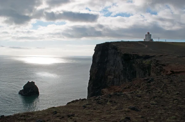
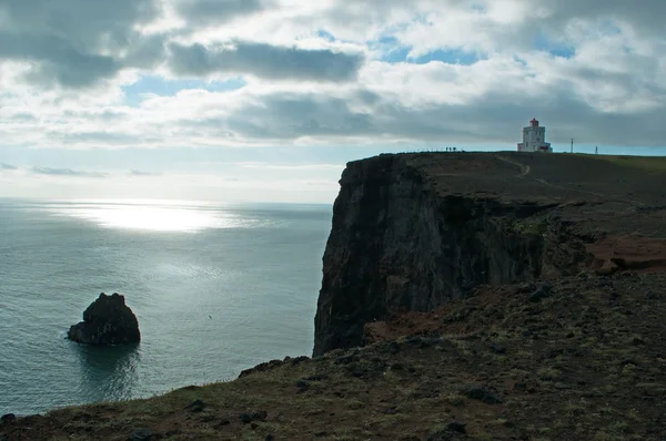
Iceland, Europe, 09/18/2012: aerial view of the breathtaking promontory of Dyrholaey and its lighthouse Dyrholaeyjarviti overlooking the bay of Vik i Myrdal, the southernmost village of the island along the Ring Road
Iceland, Europe: aerial view of the breathtaking promontory of Dyrholaey and its lighthouse Dyrholaeyjarviti overlooking the bay of Vik i Myrdal, the southernmost village of the island along the Ring Road — 스톡 사진
포 르 멘 테라, 발레아레스 섬, 스페인, 2010 년 9 월 11 일: 푼 타 프리마, 토 드와 섬의 동부 쪽 케이프의 절벽의 항공 보기 sa 푼 타 프리마, 해안을 제어 하는 17 세기 망루
포 르 멘 테라, 발레아레스 섬, 스페인: 푼 타 프리마, 토 드와 섬의 동부 쪽 케이프의 절벽의 항공 보기 sa 푼 타 프리마, 해안을 제어 하는 17 세기 망루 — 스톡 사진
아이슬란드, 2012년 09월 18일: 디롤레이(Dyrholaey)의 곶에 바다에 서 있는 거대한 검은 색 아치의 공중 전경과 섬의 최남단 마을인 빅 i 미르달만이 내려다보이는 남부 의 주요 관광 명소 중 하나
Iceland, Europe: aerial view of the gigantic black arch of lava standing in the sea on the promontory of Dyrholaey and overlooking the bay of Vik i Myrdal, the southernmost village of the island, one of the main tourist attractions of the south — 스톡 사진
Vik i Myrdal, 아이슬란드, 유럽, 08/18/2012: 레이니스드란가르의 전경, 레이니스피야라(Reynisfjara) 검은 해변의 레이니스피얄(Reynisfjall) 산 아래 현무암 바다가 쌓여 있으며, 1991년에 세계에서 가장 아름다운 10개의 비열대 해변 중 하나로 선정되었습니다.
Vik i Myrdal, 아이슬란드, 유럽: 레이니스드란가르의 전경, 레이니스피야라(Reynisfjara) 검은 해변의 레이니스피얄(Reynisfjall) 산 아래에 있는 현무암 바다는 1991년에 세계에서 가장 아름다운 10개의 비열대 해변 중 하나로 선정되었습니다. — 스톡 사진
Iceland, Europe, 09/18/2012: aerial view of the breathtaking promontory of Dyrholaey and its lighthouse Dyrholaeyjarviti overlooking the bay of Vik i Myrdal, the southernmost village of the island along the Ring Road
Iceland, Europe: aerial view of the breathtaking promontory of Dyrholaey and its lighthouse Dyrholaeyjarviti overlooking the bay of Vik i Myrdal, the southernmost village of the island along the Ring Road — 스톡 사진
Iceland, Europe, 08/16/2012: aerial view of the rocks and the black beach of Krysuvikurberg Cliffs, one of the most striking landscapes of the island, a 6-kilometer wide cliff located in the geothermal area of Krysuvik, on the Reykjanes peninsula
아이슬란드, 유럽: 레이캬네스 반도의 지열 지대에 위치한 6km 너비의 절벽인 크리수비쿠르베르크 절벽의 바위와 검은 해변을 조망할 수 있습니다. — 스톡 사진
포 르 멘 테라, 발레아레스 섬, 스페인, 2010 년 9 월 11 일: 푼 타 프리마, 토 드와 섬의 동부 쪽 케이프의 절벽의 항공 보기 sa 푼 타 프리마, 해안을 제어 하는 17 세기 망루
포 르 멘 테라, 발레아레스 섬, 스페인: 푼 타 프리마, 토 드와 섬의 동부 쪽 케이프의 절벽의 항공 보기 sa 푼 타 프리마, 해안을 제어 하는 17 세기 망루 — 스톡 사진
Iceland, Europe, 09/18/2012: aerial view of the breathtaking promontory of Dyrholaey and its lighthouse Dyrholaeyjarviti overlooking the bay of Vik i Myrdal, the southernmost village of the island along the Ring Road
Iceland, Europe: aerial view of the breathtaking promontory of Dyrholaey and its lighthouse Dyrholaeyjarviti overlooking the bay of Vik i Myrdal, the southernmost village of the island along the Ring Road — 스톡 사진
아이슬란드, 2012년 09월 18일: 디롤레이(Dyrholaey)의 곶에 바다에 서 있는 거대한 검은 색 아치의 공중 전경과 섬의 최남단 마을인 빅 i 미르달만이 내려다보이는 남부 의 주요 관광 명소 중 하나
Iceland, Europe: aerial view of the gigantic black arch of lava standing in the sea on the promontory of Dyrholaey and overlooking the bay of Vik i Myrdal, the southernmost village of the island, one of the main tourist attractions of the south — 스톡 사진

사용 정보

표준 또는 확장 라이센스에 따라 이 로열티-프리 "Iceland, Europe: aerial view of the gigantic black arch of lava standing in the sea on the promontory of Dyrholaey and overlooking the bay of Vik i Myrdal, the southernmost village of the island, one of the main tourist attractions of the south" 사진을 개인적 및 상업적 목적으로 사용할 수 있습니다. 표준 라이센스는 광고, UI 디자인, 제품 패키지를 비롯한 대부분의 사용을 커버하며, 최대 500,000부까지 인쇄할 수 있습니다. 확장 라이센스는 무제한 인쇄 권한과 함께 표준 라이센스 하의 모든 사용을 커버하며 다운로드한 스톡 이미지를 상품, 제품 재판매 또는 무료 배포에 사용할 수 있도록 합니다.

이 스톡 사진 구입 시 최대 4288x2848 의 고해상도로 다운로드할 수 있습니다. 업데이트 날짜: 2016년 7월 16일